Amherst History Month By Month: Maps And Historic Preservation
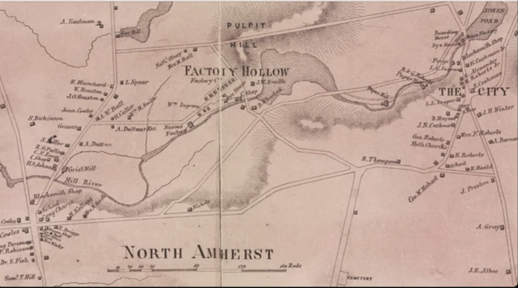
Map of North Amherst Mill District in the late 19th century encompassing the area in which the North Amherst History Trail will be constructed.
“Are you lost?” If you are, click on Google maps to manage your morning commute or navigate to another destination. Or reach for a paper map. The trunk of my car is full of them, offering visual memories of family vacations and visits reuniting with friends before the pandemic. These days, maps have been digitized and made available online. Did any of you ever buy the wonderful notepaper and envelopes generated from OSGS maps from Hastings in town? Increasingly we have come to hear or use the word map as a noun or adjective, as a way of talking about visualizing data or information as part of efficient and thoughtful management. This all counts when considering the role that maps play in historic preservation work today.
Of course, maps are just one of several things (sources) that are used when addressing historic preservation concerns. Along with oral history, photography, archaeological work, or the use of written documents, maps assist us in knowing our surroundings better and their changes over time. When doing a site visit, a preservation planner (or conservationist, archaeologist, or architectural historian) might use a combination of historic maps and GPS or other geospatial navigation systems to better understand a site and its context.
With the caveat that we don’t confuse the map or model with the territory, I want to share some maps circulating at the moment that help us understand New England and local history better.
The first is a map I came across at an exhibit at the Springfield Museums called “We Have a Story to Tell: Stories, Maps, and Relationship to Place” where the earliest map on display was made by a Passamaquoddy chief called Sapiel Selmo in the late 1800s. His map is inscribed on birch bark and apparently this example demonstrates a long tradition among the tribe of map-making. The map is a representation of a hunting trip that Chief Selmo’s father took him on when they went to a seasonal hunting village in what is now the East Machias Lake region in Washington, Maine. The map also shows from their camp where the moose are hiding.
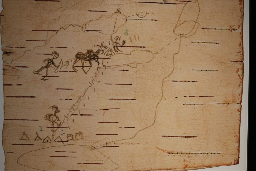
Such maps exist in relation to other indigenous wayfinding that can include marker trees, stories, and songs that still help people navigate local trails. Similar trends in wayfinding occurred here in the Connecticut Valley as well as in Maine. The map helped to describe or represent what was really there.
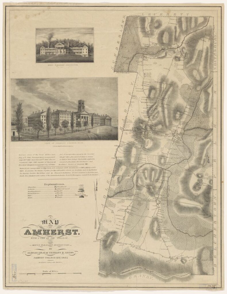
The Library at Harvard University has scanned many interesting historic maps including this one of Amherst, dated 1835. It is a wonderful resource for preservation because it shows ownership of most properties at that time as well as the prominent place given to Amherst College, which is also shown in special inserts. Where, it is still relevant to ask, would Amherst be without Amherst College? In 1835, the college, founded in 1821, was reserved only for men and it would be another couple of years before Mount Holyoke Seminary was started in South Hadley by Mary Lyon in 1837. The map intrigues me for it shows a second insert of the Mount Pleasant Institution on the hill that is still known as Mount Pleasant today. This was also a school for boys, graduating among others, Henry Ward Beecher, in 1834. According to the town history by Carpenter and Morehouse there was also a school for girls here.
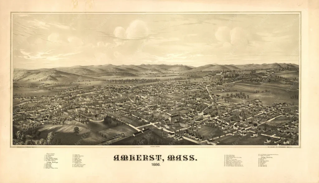
Another map, available online from the Library of Congress, as well as in facsimile through commercial outlets, shows Amherst in 1886. A significant feature here is the way in which a ‘birds eye view” perspective has assisted in showing the viewer that Emily Dickinson and her family’s Homestead lived in close proximity to the Hills Hat making factory that was apparently the largest palm leaf hat manufacturing company in the country at this time.
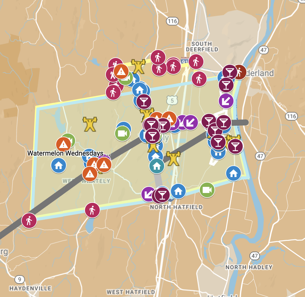
Maps and mapping are currently on the mind of the Historical Commission in Amherst as we recommended a grant be awarded in 2021-2 through the Community Preservation Act Committee to the Mill River project, administered in part by the District One Neighborhood Association (DONA). The Mill River Trail Project sought funds related to the development of an historic interpretive trail on public conservation land in and around the Mill River Recreation area in North Amherst for the purpose of protecting and preserving the remains of 19th-century mill sites there. The group also hopes to educate the public about this period of Amherst’s manufacturing history as represented in the archaeology and cultural landscape. The committee is currently managing both research as well as planning and outreach about the project and is looking at a variety of possible local history mapping projects for models of how to go about creating interpretive plans. One possible example is administered online by the Whately Historical Commission and others are in Brookfield, and Acton, MA
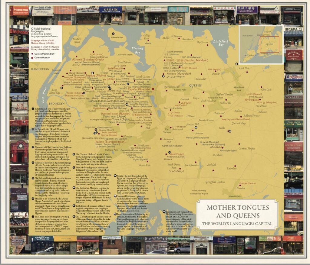
Sometimes digital mapping can be very “tipped towards consumerism” according to the cultural critic and writer Rebecca Solnit and she mentions that maps of towns tend to only show shops and restaurants rather than trails and areas of conservation land that are publically accessible. In an effort to change this, Solnit shared this wonderful map of linguistic diversity in Queens, New York and this reinforces the point that maps can be used for a very diverse range of purposes. If you haven’t discovered the site called “Simon shows you maps” it is worth a quick look.