Photos of the Week: Pocumtuck Valley Landforms Now and Then

The Pelham Hills begin rising less than 3 miles away from Mt. Pollux. This landform, with an elevation highpoint of 1,250 feet, forms the eastern edge of the Pioneer Valley, and is actually a structural dome with gneiss rock arching from east to west and surrounded on all but its west face by the Bronson Hill terrane. Photo: Pioneer Valley Landform Observatory
by The Pioneer Valley Landform Observatory
Mount Pollux Through the Ages: VR Exhibit on Pioneer Valley Landform Observatory Site
Thomas Johnson of Friends of Mount Pollux reports that there are VR images of Mount Pollux as it appeared 7,000 years ago at the end of the last Ice Age when all but its summit was covered by glacial Lake Hitchcock, now posted on the Pioneer Valley Landform Observatory web site. See the photos below to check out how the landscape has changed over time. More photos are coming to the web site soon.
Geological History
Mount Pollux is one of two glacial drumlins in Amherst (the other being Mt. Castor) formed 50,000 years ago. The 360-degree view from the 345-foot summit affords views of the Pocumtuck (Pioneer) Valley and surrounding highlands, which, according to Johnson, “are the site of remarkable geohistorical events stretching back as far as when continents collided 485 million years ago and formed the Berkshires to the west, to the recent formation of Lake Hitchcock at the end of the last ice age 7,000 years ago. The Pelham Hills to the east (330 million years old) are the remnant of a towering “altiplano” that covered what is now central Massachusetts, while the Holyoke Range forming the south edge of the Pocumtuck Valley was created by the rifting of the Connecticut River Basin 200 million years ago.”
Below are now-and-then” images of the Berkshires, Lake Hitchcock and the ancient rift valley which became today’s Connecticut River basin.
Read about the observatory here and here. Visit the web site to see these photos in dynamic VR beforer and after form and to find new photos that will be added in the coming weeks.
The Berkshires: Change over Time
Looking west around 400 Ma from the current location of Mt. Pollux the view would have been of tall Alps-like mountains which preceded the Berkshires. Western Massachusetts was covered by the Taconic Highlands created during the Taconic and Acadian orogenies. Mega annum (abbreviated as Ma) is a scientifi unit of time equal to one million years, with “ago” implied. The first orogeny began around 515 Ma when the first peri-Godwanan terrane (“Moretown”) collided with the North American continent, Laurentia. This created the “Iapetan Suture” which runs north-south, somewhat east of the present Berkshires spine.
.

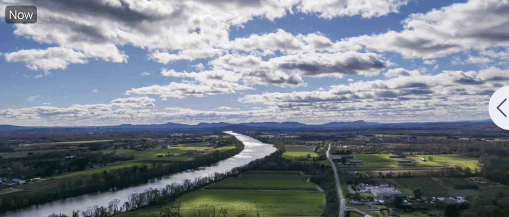
Lake Hitchcock: Changes over Time
This now-and-then VR image shows the view from the top of the Mt. Pollux parking area looking south towards the Holyoke range. The surface of Lake Hitchcock has been determined by geoscientists to have been 300 feet above sea level. Mt. Pollux, at 345 feet, was an island in the lake, as were Mt. Castor, Mt. Warner and the Amherst Block (today the site of Amherst College and downtown). It so happens that the elevation of the top of the parking area is 300 feet, and hence the site of the ancient Lake Hitchcock shoreline.


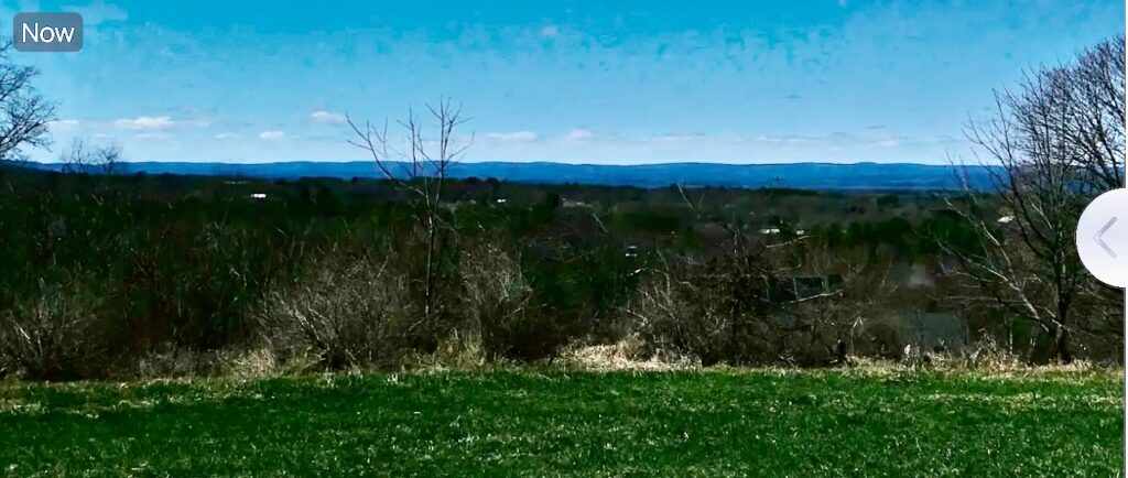
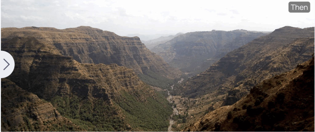
The Rift Valley: Change over Time
The “then” image of the Great Rift Valley in Africa today illustrates what the present Connecticut River Valley (image taken looking south from Mt. Sugarloaf in South Deerfield) may have looked like around 200 Ma when the Valley was a fault basin and rift valley. The sedimentary basin which filled the ancient rift valley, running north from New Haven, CT to just north of the Pioneer Valley, has an average width of 17 miles and depth of up to 16,000 feet, giving the observer today an idea of the rift valley’s size and great depth. Refer to Richard D. Little’s book, Dinosaurs, Dunes and Drifting Continents on “formation of the Connecticut River Valley” for further information.
Love this info!!!