Letter: Fort River Watershed Needs Retention Dams With Navigable Spillways
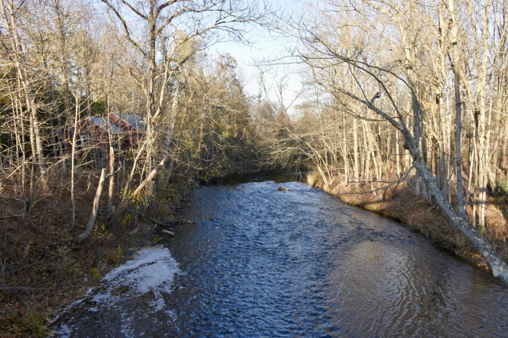
Fort River viewed from the Rt. 116 Bridge looking southeast. Photo: Art Keene
The following letter was sent to the Town Manager, Conservation Director, Superintendent of Public Works and several elected officials on August 2, 2021.
Fort River is suffering greatly because of all the drainage, especially apartment projects in the swamps and now solar panels (Free land for the Law makers to use/ruin with pet projects), and overuse of water. Much of the significant damage transpired in the last few decades and goes on unabated. Added sewer vs septic systems moved water downstream from where it is taken and used. Rain water is shunted downstream, lowering the entire water table; resulting in frequent flash floods. Removal of most of the dams; except the one that actually mattered in Holyoke, degraded the entire system. Small dams with navigable spillways raise the local water table increasing wetlands and provide a steady supply of water for much longer into dry spells. This in turn keeps the temperature moderated. Headwaters of a lot of the brooks are spring fed and some still hold cold water fish; specifically Brook Trout. Fearing Brook is not the only buried and or drained feeder tributary. As the local ponds disappeared the geese and ducks congregated at Puffers; contaminating the pond with bacteria.
Local actions relative too the fort river watershed are the biggest climate change issue we have. When dry, the whole area is cooled, and water flowed for a much longer period of time. Floods were held back naturally. Plumb Brook was redirected from where it used to flow into Muddy Brook; illegally! This drained a large area of adjacent wetlands and ponds. Amherst’s Village center drained all the wetlands along the bike path loosing square miles of pond.
Potentially this can be made worse by external forces and or acts of God. (No FEMA insurance because the developers have designated it as not flood plain). 1936 or 1939 floods, if repeated, will overflow all the flood control dams and the Connecticut river will swallow the entire Fort River. All the telephone poles in Hadley will be fully submerged and then some.
Many people over the years, and recently Kim Harwood have maintained “Public easements by right”- trails up and down Frenchie’s Brook (Also known as West’s Brook). These trails should be mapped and joined to the Planned and existing Fort River trails.
Fixing lost ponds would provide a deep cold water swimming hole for the neighborhood and significant trout habitat. Other dams on Frenchie’s Brook should be fixed. Orchard Brook and the Hampshire College tributary that feed Market’s Pond and enter the Fort River next to Frenchie’s Brook need to be unburied and refilled with water. Culverts above the pond are deteriorating.
(The town denies that these exist on their maps but they are clearly shown on the 1969 topo maps).
There is a long list of things that should be corrected and some are relatively easy. No dams on the Fort River is not a good idea; historically it would have been a series of Beaver Dams; flooding large areas. Put in spillways that the fish and or canoes can navigate. Weirs were installed to keep fish in the pond for consumption; lets get rid of the one at Markert’s). Plantings only retain so much. Margins of the watershed are rapidly disappearing; a viable year round habitat is all but gone. The entire system is suffering from lack of water and or flash floods. Water redirected into Atkins and then into Mill River should be redirected back into the Fort River System; a significant and easy improvement.
John Boothroyd
John Boothroyd is a resident of District 5 in Amherst
John,
Would it be possible to include a map, or map, with this letter? Or links to maps? Maps that include names for the bodies of water you reference.
You give names to bodies of water which are unnamed on any available maps (even 1969 USGS topos).
I appreciate hearing your interesting perspective on the current focus and efforts to manage the Fort River watershed. More context and background explanation could help improve everyone’s understanding.
John, I appreciate your passion for the Fort River. As I am sure you know, there are some exciting things being done to help protect it. I am particularly excited about the impact of no longer being hit by chemicals from Hickory Ridge as it runs through that land.
Eric, I don’t know if this is what prompted John’s letter, but here is an article about those efforts: https://www.gazettenet.com/Protection-of-the-Fort-River-watershed-a-multi-pronged-effort-in-Amherst-41589854
As for your comment about private trails being formally mapped. Speaking as a resident and not in any other capacity, I would say that for that to happen, any legitimate easements would need to be formally documented, and any trails or maintenance work done would need to be permitted (even retroactively) and in compliance with state and local bylaw (e.g. the Wetlands Protection Act). I love the idea of a more robust mapping of the publicly accessible trails in our town.
John, there are three members of the Conservation Commission whose terms expire in 2022. I highly recommend filling out a Community Activity Form if you would ever be interested in joining and helping to protect these resources!