Town Prepares To Adopt New Flood Maps
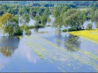
Photo: amherstma.gov
Report On The Meeting Of The Community Resources Committee, May 26, 2022
The meeting was held over Zoom and was recorded. It can be viewed here.
Present
Mandi Jo Hanneke (Chair), Pat DeAngelis (District 2) , Jennifer Taub (District 3), Shalini Bahl-Milne (District 5). Absent: Pam Rooney (District 4). DeAngelis left at 5:00 p.m.
Staff: David Ziomenk (Assistant Town Manager), Christine Brestrup (Planning Director), Nate Malloy (Planner), Jennifer Moss(engineering consultant)
Public Hearing On Zoning Article 16, FEMA Floodplain Overlay District
The hearing was to receive feedback from the public and answer questions concerning adoption of new floodplain maps for the town.
The town has been working on revising these maps since 2012. The purpose of the floodplain maps is to create a set of federally approved maps to provide accurate information delineating 100-year floodplain areas, that is, areas that have a 1% chance of flooding in a given year. These maps are issued by the Federal Emergency Management Agency (FEMA) for the administration of the National Flood Insurance Program (FIRM). FIRM maps are used to create floodplain management regulations, which protect the public health, safety, and general welfare, and minimize the harmful impacts of flooding on the community.
The previous update of the town’s maps was in 1983. Since then, mapping technology has improved considerably. The new maps are much more accurate and are based on one-foot contour lines instead of the ten-foot contour lines of the old maps. These new maps were compiled in 2017 and were presented at a variety of public meetings in 2019.
A previous presentation to the Planning Board, explaining the new maps can be viewed here.
A composite map showing the floodplains as determined on the old maps (cross-hatched area) and based on the one-foot contours (blue area) is presented below. Any project proposed to be built within the floodplain requires a permit from the town. A full set of flood maps can be found here, and the insurance study conducted for the town can be found here.
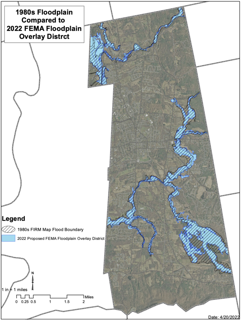
Christine Brestrup noted that if the town does not adopt these maps, Amherst will no longer be able to participate in the Federal Flood Insurance Program.
No member of the public offered comments or asked questions at the hearing.
The committee voted to continue the hearing until September 8, 2022, when more specific wording for a proposed bylaw amendment will be available.
Zoning Board of Appeals Appointments
At its last meeting, on May 12, the CRC declared that the pool for open positions on the Zoning Board of Appeals (ZBA), which remains at three applicants, is sufficient.CRC members agreed unanimously (3-0 with DeAngelis and Rooney absent) to adopt the selection guidance for ZBA appointments, previously approved on October 12, 2021.They agreed unanimously (3-0 with DeAngelis and Rooney absent) to adopt a revised set of interview questions for ZBA appointments.
Rental Permitting Bylaw
CRC continued its discussion of the proposed revised rental permitting bylaw.
Building Commissioner Rob Morra, Licensing Coordinator Steve McCarthy, and Code Enforcement Officer Jon Thompson were present to take questions on the kinds of information that they would like to see in the revised bylaw. They noted that much depends on what is going to happen with inspections and that it would be useful to have access to a monitored line for the owner/manager of the property (as opposed to a line that sometimes is answered by a machine, which is frequently the case) to provide expedient access in case of an emergency. Several questions were raised by Jennifer Taub about tracking and monitoring student rentals. Michele Miller requested that there be some kind of public forum or hearing on the revised bylaw, reporting that she is hearing from several constituents who have questions and concerns about the proposed changes.
Modification and wordsmithing of the bylaw will continue at future meetings.
1 thought on “Town Prepares To Adopt New Flood Maps”