Amherst History Month By Month: The Spaces In Between
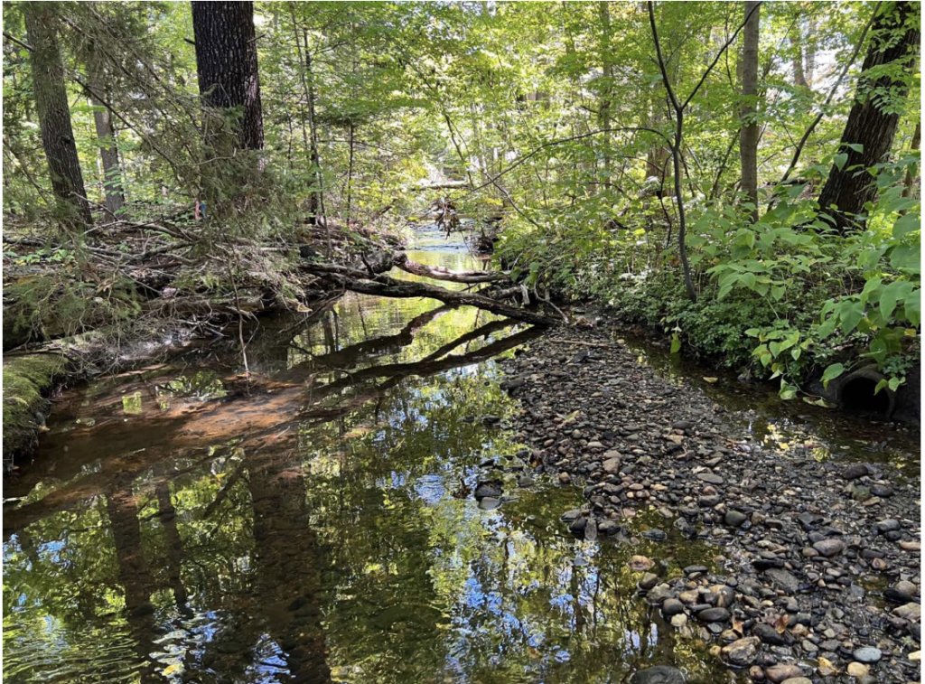
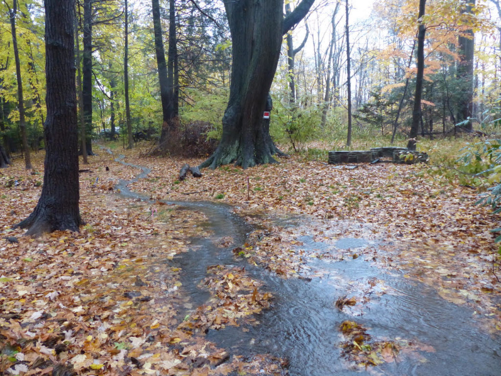
A photo of Tan Brook from a town streamflow study. (https://www.amherstma.gov/3640/Other-Wetlands-Projects). Photo: Christine Hatch
“People feel a longing to belong to the natural world wherever they live…” Robin Wall Kimmerer
In this month’s column, I want to cast light on the significance of some of the natural spaces that are important to people in Amherst. They represent parts of our town that exist in between the built environment and any necessary planned infrastructure. Much of the sheer pleasure of living in Amherst is that it is fairly easy to access a town-maintained trail or a park or wooded area or to find a great view of our surrounding hills or the valley.
The historic Amherst Center and its ‘villages’ of East, North and South Amherst are bordered by a still largely rural landscape, preserving the significance of farming historically and down to the present for this town and its citizens. When we take in a view of natural landscape (much as we might a good photograph or a painting or something we see on a screen) it is most often the case that what we are taking in is private land, some of which is managed for community supported agriculture or for recreation or for civic or commercial benefit. This is true of many of the viewsheds that we see in and around Amherst today.
In this context, there are two emerging places of concern that relate to open space and cherished natural landscape I’d like to discuss. I will talk a bit about each of them as they are both vulnerable in different ways.
The Workers’ Pavilion At The Renaissance Center
The publically-accessible Renaissance Center meadows in North Amherst are on the outer, northern most edge of the University of Massachusetts campus. The area includes donated property from the Dakin family to UMass and is an exceptionally special place, mostly comprising open fields with wonderful views for walkers and nature lovers. The area is easily accessible yet quite protected from the main road and other residential sub-divisions. Actually, how close this area is to very settled residential and high-density areas is perhaps part of its charm.
There was a proposal to build a new pavilion here, honoring UMass’s essential workers, which would be a gathering spot as well as a sheltered space near to the Dakin homestead that now houses the Renaissance Center. Those plans were placed on hold by UMass earlier this week.
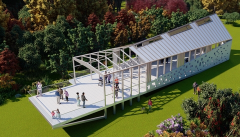
Pavilions in the right setting can be exciting and interesting architectural incidents in the landscape especially if they are designed by someone like architect Sigrid Miller Pollin who was the architect for UMass’s Crotty Hall and Gordon Hall on North Pleasant St. And in this case, the anonymous donor’s wish is also very heartfelt, honoring the many hundreds of essential workers who have served the Amherst campus throughout the pandemic. (For a very short time, I was one of those workers.) The gift is generous and timely but the proposal is misplaced for what is considered some of the most cherished open space in town. Amherst Indy is covering this story and one hopes that it will evolve into something that takes into account more the historic nature of the ‘view shed’ that is already there.
Tan Brook
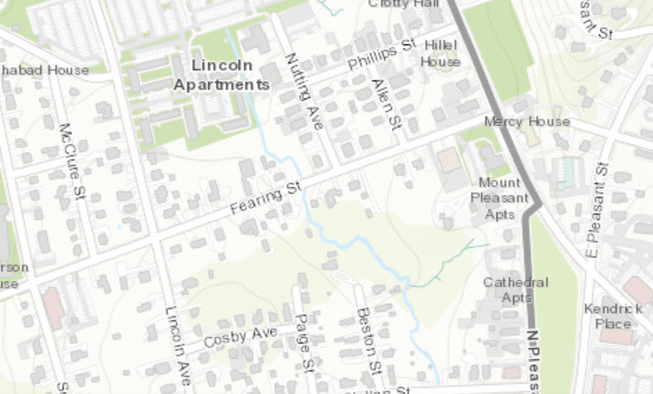
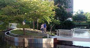
The second of my special ‘in-between’ spaces concerns the Tan Brook, a stream I have never seen run dry in my five years so far living in town. Of course, it is not as if it’s the Colorado River running through the Grand Canyon but it is still special to me. Its headwaters are at the picturesque pond by the Wildwood Cemetery. It passes by Wildwood Elementary school, continues by the middle school and the high school soccer fields, and traverses underground at Kendrick Park. It pops up again at McClellan Street, and at Fearing Street, and then feeds the UMass Campus Pond, the main water feature in the landscaped grounds of the State’s flagship campus. Maybe some of you know the little island by the Bromery Center called the Isle of View. After the Campus Pond, Tan Brook reaches a confluence with the Mill River and then makes its way to the Connecticut.
A dedicated group of concerned neighbors, in District 3, have been working to protect Tan Brook for more than a year, pitching in time and/or money to argue for the benefits of maintaining and improving an ecologically sensitive waterway and its banks in order for it to survive as a benefit to the whole town.
Amherst has responsible and thoughtful developers; however, they are trying to make Tan Brook go away and last year, one of them convinced the MA Department of Environmental Protection (DEP) that Tan Brook is intermittent, which allows more development along its banks. But the Tan Brook has never run dry. And it has been damned and has flooded in recent memory.
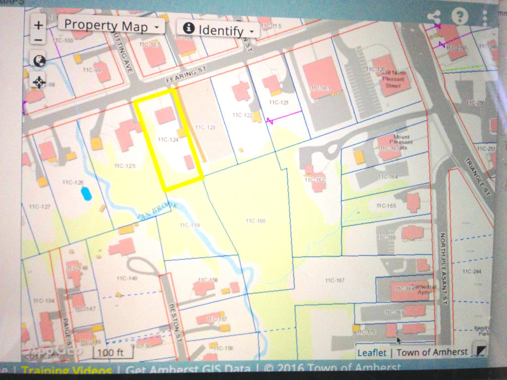
Years ago, when Tan Brook was paved over where is runs through downtown (under the high school playing fields and Kendrick Park) it was no longer visible to aerial photographers and fell off the USGS maps used to determine perennial vs. intermittent streams. The Amherst Conservation Commission designates Tan Brook as perennial, but the MA Dept. of Environmental Protection doesn’t want to change its designation. The neighborhood group has decided to appeal. Protecting Tan Brook and its wetlands is an ongoing process that will extend in all likelihood into March 2023. This group is trying to protect the area from intense overdevelopment (not development).
What could happen in this case, could be some creative ‘day-lighting’ of the stream, restoring it to is historic conditions (as has been the case with the rivers in Providence, RI). See more here. These issues are also pertinent because of the artificial turf controversy at the public school playing fields since the Tan Brook is culverted underneath the soccer fields.
Multiple things should probably happen as action steps: restoration of the brook itself, mitigation of flooding and a storm water management plan, along with more careful study of PFAS chemicals in artificial turf. More rather than less impermeable surfaces will only exacerbate the flash flooding of areas close to the downtown. And in a more philosophical turn of mind, when we take in nature it is good for us and it makes us more appreciative of nature’s gifts. For some of us these are God’s gifts, and for some of us it is a gift of the “interbeing” we as humans have with the vulnerable but beautiful natural world. Let’s sustain it.
I wanted to share with Amherst Indy readers an update to the Tan Brook concerns raised by District 3 citizens: “[one of our neighbors] reports today that, due to our efforts and that of the town Conservation Commission, [the developer] has withdrawn his initial ANRAD, thereby erasing the SORAD, and will start over seeking Conservation Commission approval of development near the Tan Brook. This time, we expect, with a proper delineation of the Tan Brook and associated wetlands.
Our work isn’t over, but this is the result we’ve been working toward; we’ve won the first round… Keep an eye out for future Tan Brook activity with the Conservation Commission.”