Amherst History Month-by-Month: Amherst’s Green Places
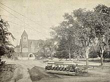
A streetcar for the Amherst and Sunderland Street Railway crosses Amherst Center, in front of the Town Hall and Town Common c. 1903. Photo: Wikipedia
I find myself using the word view-shed when discussing the issues of historic architecture and preservation in Amherst these days. As much as a building might have demonstrated significance in the categories of history and architecture, in some cases, it is the surrounding land or view-shed that is as significant. View-shed analysis is actually a specific kind of scientific evaluation in geography and planning but is used in the context of historic preservation work to refer to the cumulative effects of evaluating historic resources within a community for their integrity. View sheds in Amherst are varied, but for the purposes of this column, are the green, open spaces, forests, or meadow land that help manage our wildlife, or drinking water for example. Some are publically accessible. Planning policies such as densification in our town are ways that the municipality seeks to keep denser development near bus routes and/or shops to prevent sprawl. This strategy is balanced by maintenance of parks, trails, wetlands, and some of our historic landscapes. The effect is to help promote biodiversity and sound, sustainable environmental goals.
Read More Here: Farmlands Can Support Wildlife To Address The Biodiversity Crisis (Kestrel Land Trust)
Amherst’s green places sounds a bit vague as a term but these areas can be important for our wellbeing and aid our recreation (literally, our re-creation.) Did you ever meet a date by the fountain in Sweetser Park? Or take your kids to the water play area at Groff Park, located off Rt. 116 near Shays Street? There are several small public parks in town and three distinct village commons (the East Amherst Common near the Fort River Elementary School, the North Common, by Town Hall, that was hayed until the mid 1800s and South Amherst Common). East Amherst common was once much more commercial than it is today but some buildings in the local Historic District still give a sense of its older storefronts where tanneries, shoemakers, tool-makers and arms manufacturers existed alongside historic farms, and homes.
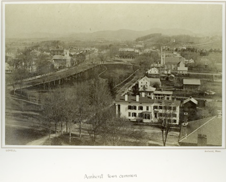
Public parks are a relatively recent phenomenon in our country, and considered the invention of Frederick Law Olmsted, who designed Central Park in New York with Calvert Vaux in 1857-8. Although this famous park obliterated an historic Black settlement called Seneca Village (near the reservoir) the fame of Olmsted’s landscape design firm grew after the Civil War, and in 1874, Emily Dickinson’s brother Austin invited the firm to help the town envision a new look for our north common by Town Hall. The Indy has followed this story as a ‘music house’ was a feature of Olmsted’s design as it was for many European parks at that time.
Groff Park, in Mill Valley, went through an exciting transformation as our town went into lockdown for the pandemic becoming an attractive water park. Here is a little more of the back story. In the 1920s and 30s, this area was a fourteen-acre farm owned by a dairyman called Ulysses Grant Groff. He was a Swiss émigré who gave the land to the town in 1934 for a public swimming hole on the Fort River – known as “Freshman River” by the old Grist Mill. This section of the river had long been a favorite place for swimming amongst Amherst College’s fraternity brothers when the school still had a Greek Life presence on campus and was not co-educational as it is now. Ball fields, picnics and fishing were promoted at Groff Park instead of swimming. As well as access to picnic areas the park also connected with the charming, meandering river walk that is now the Emily Dickinson town-maintained trail.
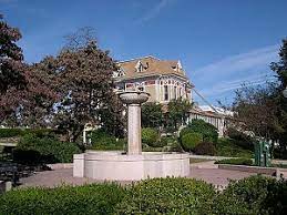
The park near Town Hall on Main Street is named for a local merchant, Luke Sweetser. He joined with Emily Dickinson’s father, Edward, to prevent development of this rather swampy triangle of land near Lessey Street. In order to avoid it becoming house lots, financed by an out of town developer in Philadelphia, this land began to be mown as a public park in 1836, and was laid out with fruit trees. It is now divided by Churchill Street into two pieces. The decorative fountain (shuttered in winter) was added in 1913 by Enos Foster Cook, and both the fountain and the park were restored by the town in the 1990s.
Before Amherst had public parks, it did have public cemeteries that were evocative resting places for the dead, filled with mausoleums, statues and gravestones. They were considered restful and often beautiful with maturing shade trees, plantings and landscape features such as ponds and gravel paths and – yes, viewsheds. Some cemeteries in America were as famous as tourist attractions like Niagara Falls. One was Green-Wood Cemetery in Kings County, New York.
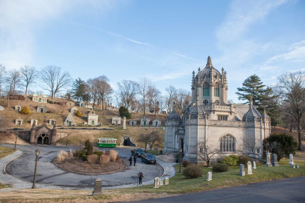
In Amherst, West Cemetery is the oldest in town dating to 1730 where grazing livestock (mostly sheep) kept the grass trimmed. This burial ground retains some of the oldest unaltered topography in town. It is the sacred ground of the Dickinson family burial plot and of “soldiers of the 54th Massachusetts Volunteer Infantry Regiment and of the 5th Cavalry, who alerted Texas residents that the Civil War and slavery had ended…” [Anika Lopes, Ancestral Bridges]. When thinking of a more park like setting for the dead, Wildwood Cemetery comes to mind, established as a non-denominational burying ground in 1887.
Amherst also has many public trails like Eastman Brook trail that is maintained by the Kestral Land Trust. Eastman Brook is “home to breathtaking open fields perfect for bird watching and seeing butterflies flutter about…. There are… wetlands and beaver dams as well as a rushing brook with accessible vantage points to view it along the trail {viewsheds again}. It is close to the Robert Frost Trail that is also worth checking out as it is very long, taking in land in other towns apart from Amherst, through farmland, forests, hillsides and gorgeous scenery.
Here is more about Central Park and its significance as the place of the Lenape homelands and Seneca Village
https://www.wilderness.org/articles/blog/central-park-came-seneca-village-black-community-hidden-heart-manhattan?fbclid=IwAR3Y6GyO3U-36Y_QX6JRYOo6MVrxDMahWk09FxjPDuO3ptwXBeQgyit6qTs
The wonderful (but rather low res) photograph used as a thumbnail for this article of town common in c. 1903 showing a street car making its way round Main and Pleasant Streets comes from a book called Through Turkey Pass to Amherst and Beyond by Alice M. Walker (nee Morehouse) (1855-1929). The book is on the Internet Archive.
One of the grandest public parks in MA that is similar to Central Park is the Boston Public Garden that began as a Botanic Garden.
https://www.nps.gov/places/boston-public-garden.htm#:~:text=While%20it%20is%20adjacent%20to,boats%20for%20visitors%20to%20ride.
Fqky0cUXsAATKsA.jpg